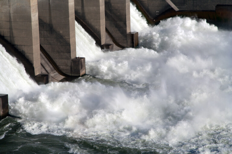
Transport
“The war in Syria more than a climate conflict”
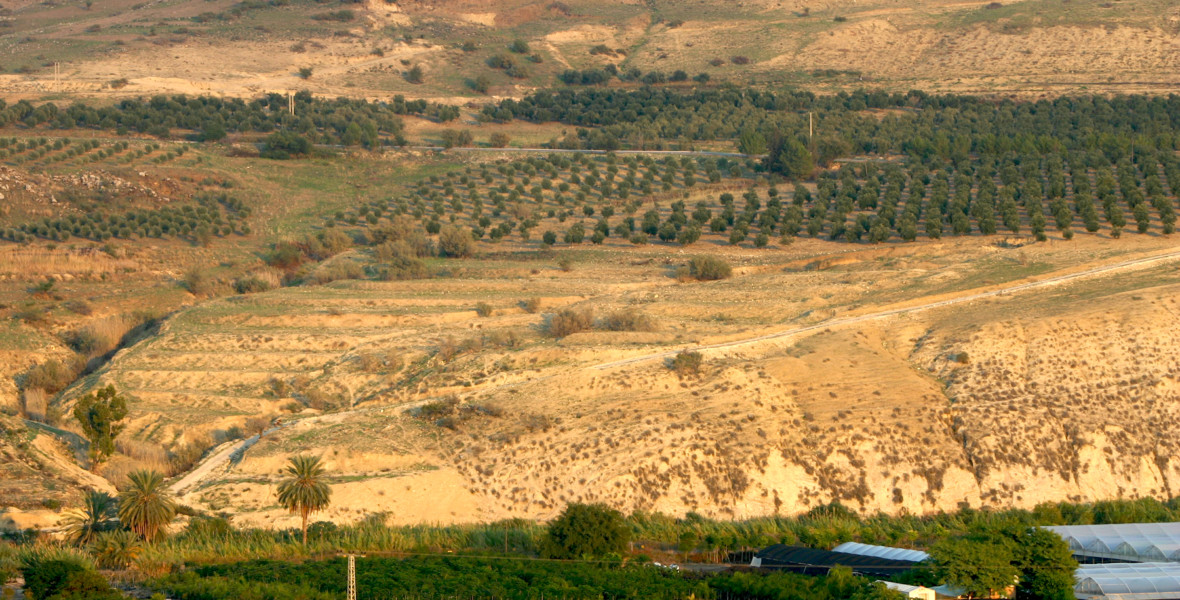
The severe drought between 2007 and 2009 has been highlighted as a reason for the war breaking out in Syria. Lina Eklund, researcher at the Center for Middle Eastern Studies at Lund University, believes that the situation is more nuanced. Using satellite images, she wants to shift the focus from the drought to how we can avoid this happening again.
Subscribe to Extrakt newsletter!
Läs mer
Stay up to date! Get the knowledge, ideas and new solutions for a sustainable society.
Personal data is stored only for the mailing of Extrakt newsletters and information related to Extrakt’s operations. You can cancel the newsletter at any time, which means you will no longer receive any emails from us
The drought that hit Syria in 2007 for several years to come had major consequences for the country. When harvests failed, people left the countryside and moved to the cities, where harsh living conditions with both job and housing shortages awaited them. In 2011, protests erupted that escalated into the war that is still going on. According to a research report, as many as one and a half million people have fled to the cities, but these are figures that have not been confirmed, says physical geography researcher Lina Eklund. The war in Syria has sometimes been described as a climate conflict, something she disputes.
“The rapid increase in urban populations led to problems and, combined with dissatisfaction with the regime, may have increased the risk of conflict. But it is a simplistic and somewhat speculative narrative that Syria would be a climate conflict. I firmly believe that the drought had an effect, but we do not know how and to what extent.”
“We should be careful saying what the causes of the war are before we know for sure. It marginalises all the other problems, such as problems of democracy, unemployment and injustice.”
Satellite images provide information
Knowing exactly how many people moved from the countryside during and after the drought in Syria is an important piece of the puzzle for understanding developments in Syria, says Eklund – a piece of the puzzle that is still missing. The figure in the research report, which states that one and a half million people moved to the cities, is based on an estimate made by one of the UN agencies on the ground. The figure has since been used in several contexts without being verified.
In a new research project at the Center for Middle Eastern Studies at Lund University, Eklund and her colleagues want to establish how the use of Syria’s agricultural land changed in the years before, during and after the drought and the war that followed.
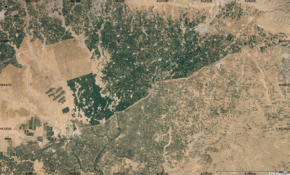
“We’ll look at satellite images from 2000 to 2018 to see how agriculture was changing. The images provide a good source of information. Not everything is there, but we can see where changes are taking place, to what extent and when. What we don’t know is why, and who or what is causing the changes. So we supplement the information with data on precipitation and interviews with people who were in the area, and then put the pieces together into an overall picture.”
Agriculture under ISIS
Two years ago, Eklund and her research colleagues used the same method to see how agriculture changed in the regions that ISIS took over in Syria and Iraq. The study showed that agricultural operations were far from being over under ISIS control in 2015 compared to the period 2000-2013 – contrary to what Eklund had expected.
“We thought that agriculture would have declined because people moved away, but we could see that more land was being cultivated when ISIS controlled the areas. Just because a war is going on does not stop everything. You might see that domestic production becomes even more important because it is often difficult to import food. In the case of ISIS, this is probably related to the fact that they want to form a state and show that they can provide their citizens with food,” Eklund says.
She has also studied migration in a neighbouring area of Syria, Iraqi Kurdistan, where very few cited drought as the cause of migration. She also did not see any large movements of people during the drought period 2007-2009.
“We now want to look at Syria in a similar way – we haven’t done that yet. What I see is that there are no major changes in land use, no abandoned land, that support the idea of massive population movements from rural areas.”
Important for reconstruction
This time, too, it is not possible for Lina Eklund to travel to Syria. She notes that it is challenging to research a conflict area of this kind, but believes that such work is still important.
“It can be difficult, for example, to verify that what we see on the satellite images is true. But that doesn’t mean we shouldn’t do this research. We lack a lot of information about Syria and Iraq, which I have also researched. So if we can do something based on the satellite imagery and interviews we’ll get a better picture of what’s going on, which will benefit us a lot once Syria is rebuilt.”
CONSEQUENCES OF CLIMATE STRESS ON SOCIETY
Full title of the research project: Societal impacts of climate stress: An integrated assessment of drought, vulnerability and conflict in Syria.
Participants: The project is being carried out by three researchers at the Centre for Middle Eastern Studies at Lund University: Lina Eklund, Pinar Dinc and Petter Pilesjö.
Implementation: 2020-2022, with funding from Formas.
RESEARCH ON CLIMATE CHANGE AND MIGRATION
In a study published in Nature, scientists predict that climate change will play a large part in armed conflicts in the future unless established climate goals are met.
Neil Adger, professor of human geography at the University of Exeter, has researched extensively on climate refugees. In addition to the study above, he has also published a study from June 2019 on the relationship between climate and conflict. One conclusion is that climate change has affected several inter-community conflicts, but equally important are factors like poverty and deficiencies in welfare and central government administration.
A UK report examines the impact that environmental disasters like floods and droughts will have on refugee flows over the next 50 years.
The Swedish International Development Cooperation Agency Sida has also published a report on climate change and conflict as part of its task to analyse the impact of environmental and climate change on the risk of violent conflicts.